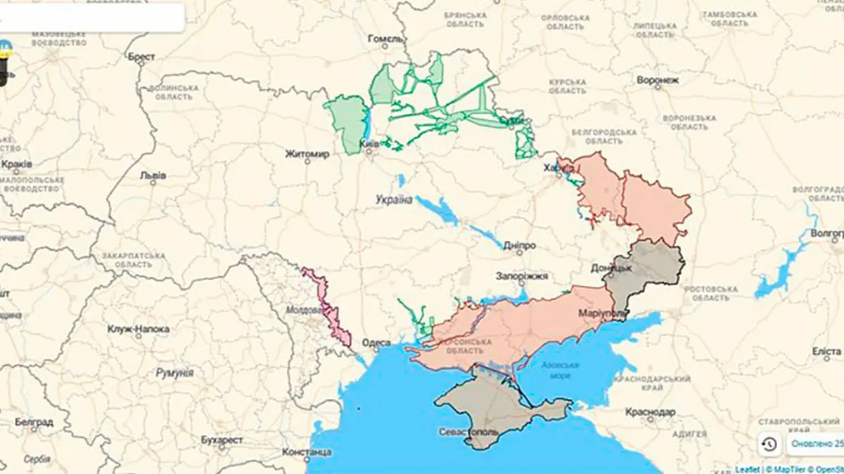
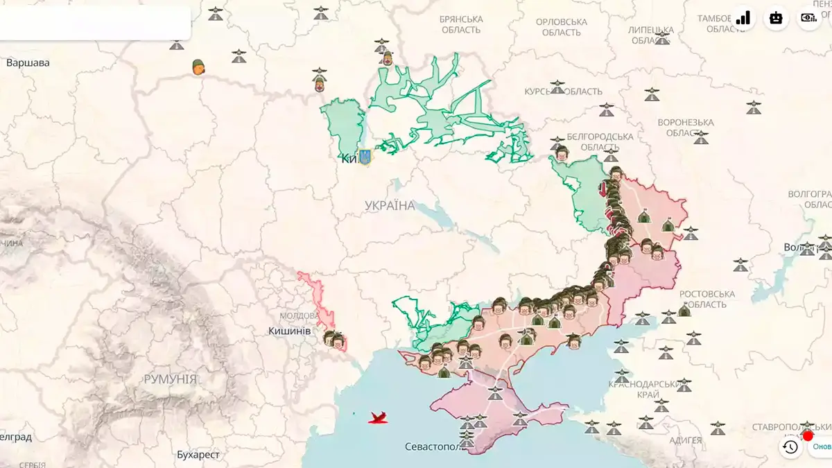
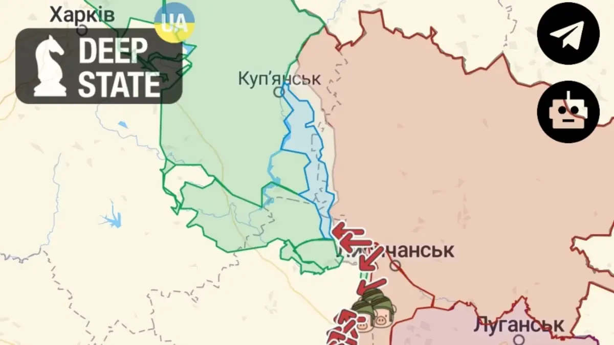
In the conditions of full-scale war, everyone wants to be the first to know frontline news and always have fresh and reliable information at hand. This is why various Telegram channels with news are so popular. Another consistently popular resource is the Deep State War Map. Here, in a convenient format, you can find up-to-date information about the frontline and other important aspects of the war in Ukraine.
Current Online Deep State War Map
What Information Іs on the Deep State Map?
One reason the Deep State War Map is in such high demand among Ukrainians and users from other countries is the wealth of useful and current information it provides. On a single map, you can see:
- Where battles are taking place in Ukraine and the directions of the occupiers’ attacks, identifying the hottest points on the frontline. Positions of Russian troops, even those far from our borders, are marked and labeled.
- Occupied and liberated territories. The Deep State map is updated daily, but information on changes is retained, allowing users to use the calendar at the bottom of the page to go back in time and see what the map looked like on any day since April 2022. You can see when and how each de-occupied settlement was liberated. Occupied territories outside Ukraine are also marked.
The Deep State War Map in Ukraine also has several additional features that users appreciate:
- Distance Measurement and Route Planning Tools: While not recommended for planning safe routes near conflict zones, these tools are very useful for analyzing the situation.
- Map Base Options: Users can choose between a standard map, a topographic map, or a satellite view.
- Artillery Range Measurement: Tools to measure the range of various artillery weapons.
- Nuclear Strike Simulation: Simulate a nuclear strike based on the charge weight.
- Viewing Enemy Fortifications. Different types of defensive structures are marked in various colors on the map.
- Mobile App. For those who use smartphones more frequently, there is the DeepStateMap app for mobile devices.
Additionally, there is a purely entertaining feature – if you click on the Kyiv icon, a drone activates that can be used to destroy enemy positions on the Deep State map.

Markers on the Deep State Map
All markers on the Deep State map are intuitively understandable. Anyone familiar with how the fighting in Ukraine began and continues can guess what each color represents:
- Various shades of red – occupied territories (ORDLO, since 2022, and foreign).
- Green – de-occupied territories.
- Blue – recently liberated areas.
- Gray – areas of active combat where control is uncertain or changes hands frequently.
Enemy units, headquarters, and airfields can be marked with standard NATO symbols or humorous caricatures of the occupiers. Red arrows indicate enemy attack directions, and black-and-white stripes denote railways.
History of the Deep State War Map
The namesake project was founded several years before the full-scale invasion by young guys—student Roman Pogorily and marketer Ruslan Mykula. They ran a Telegram channel with 10,000 subscribers, publishing reviews of international events, geopolitical news, COVID-19, BLM in the USA, the war in Syria, and events in Karabakh.

When Russian troops began massing near the Ukrainian border, the guys became interested in these events and started analyzing troop movements. When fighting began in Ukraine, they decided to map enemy troop movements. The first Deep State war map was created on the Google Maps platform, but this did not work out. The initial version of Deep State was blocked twice by Google. It is unclear whether this was due to Russian actions or the platform’s unwillingness to be associated with the conflict in Ukraine. After losing their work due to these blockages, the founders decided to create their independent website, free from external threats.
Thus, the small Telegram channel DeepState transformed into a serious project interacting with the Ministry of Defense of Ukraine and trusted by millions of users.
Conclusions
The Deep State war map has become one of the most important sources of information during the war. Its main advantages are its relevance and reliability. The creators meticulously verify all data before showing it to users. The Deep State Map is even used by the Ministry of Defense of Ukraine.
Frequently Asked Questions about Deep State
Updates to Deep State occur daily, and if there are several significant changes, updates happen multiple times a day.
Updates occur as soon as changes are confirmed and if the military allows the publication of the information. Premature disclosure can be dangerous in war conditions.
The situation at the front is very dynamic and can change in minutes. No map can show it in real time.
The Deep State war map is currently available in Ukrainian and English.


